Loci Available on Windows Store for HoloLens

Buy Loci On Windows Store

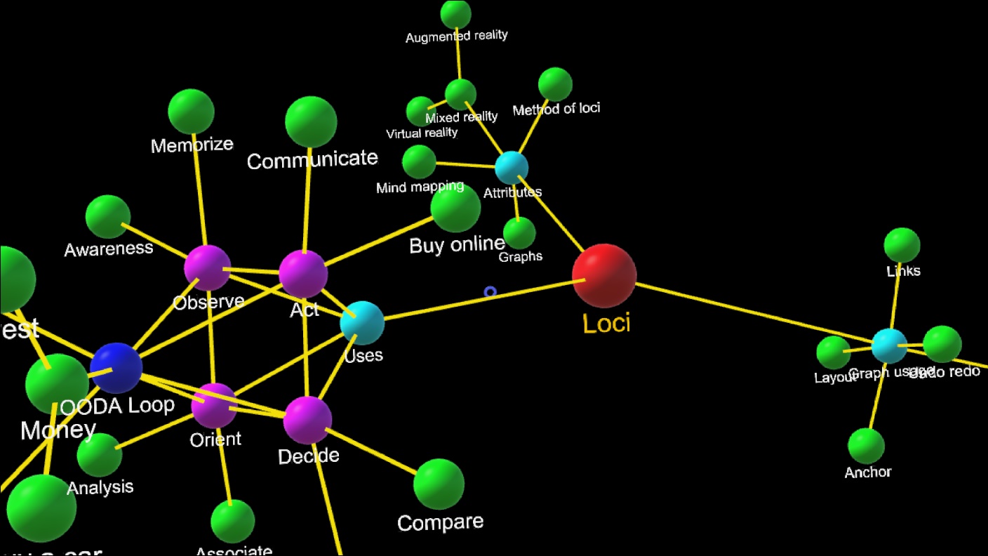
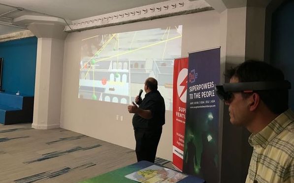
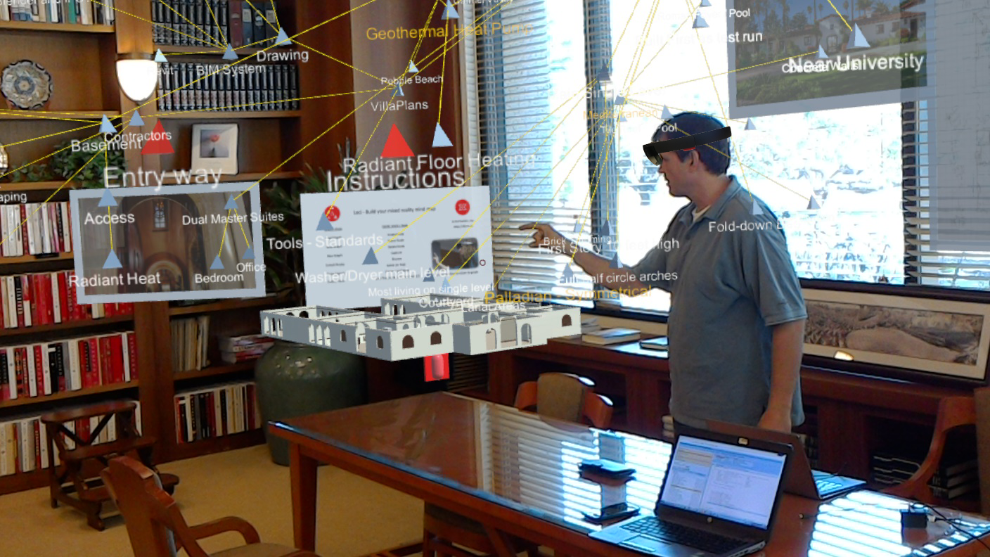
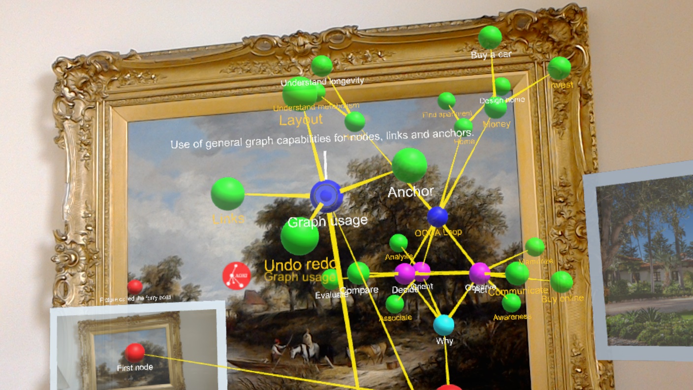
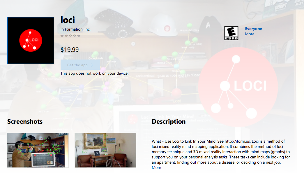
On April 15, 2017 we published version 1.0 of the Loci universal windows application for HoloLens on the Windows Store.  Loci lets you create mind maps  in mixed reality where you place the mind map nodes in your home or office in locations that have meaning to you.   Using locations in this way, as a form of method of loci, where you associate your thoughts and ideas with locations, has been shown to increase your recall of them later.

Get Loci for HoloLens on Windows Store
HoloLens

Our Loci application allows you to create and edit mind maps in mixed reality. You save and load these using OneDrive.  The primary way to interact with Loci is using voice and gaze, and the current supported language is English. To understand how Loci works, it has a free one day trial.

Yarn and Photos In Movies and TV

Loci can be used for many things since it is for general analysis.

Analysis in Movies and TV often involves links of string or yarn, pictures of people and maps, all of which are possible using Loci, and since Loci is digital, you can modify them easily, move them, and use the same space for different versions.

One example of red yarn on physical objects and miniatures on TV is the opening credits for the 11.22.63 series.  Another is the opening credits for Person of Interest.

The Big Board
String Theory
Crime Map

Graphs

Loci is a general graph editor that supports mind map graphs. Graphs consist of nodes and edges. We call nodes with locations loci, and edges associating loci we call links.

node + location in real world = locus (loci is plural)
edge = relation = association = link

Many items in life can be understood using graphs. From molecules to web page links to friends of your friends, you can think of things as the nodes, and relations between them as the links.

Graphs are used in mathematics, physics, and informatics as underlying representations for solving problems.  Graph data structures are used for 3D games to manage the application of transformations, and Loci itself uses such a scene graph to draw all the things it shows.

Most mind map software requires a central concept node, and links to other nodes, with no node being unlinked, and all being directly, or indirectly connected to the central node.  Loci does not require that.   Nodes can be solitary, or multiply connected.   In this way we support the analysis process from end to end.   You can make unlinked notes for things as you observe them, or your ideas as you come upon them, then orient your thoughts by linking them together to make sense of them.

Loci Demo of Analysis for ARBA (AWE Nite SF)

ARBA demo of Loci Analysis

On Tuesday October 25, 2016 we provided a demonstration of Loci to the Augmented Reality SF Bay Area (ARBA) Meetup (now AWE Nite SF), which was held at the Runway Incubator in the Twitter building in San Francisco.

Here is the link describing the ARBA meeting on medium.

We showed the use of Loci for mind map graph analysis of designing a home, starting with a central concept of home design, and expanding to attributes of the home, such as design family, location, features, permitting, materials, floorplan and other items.  We associated nodes with images from a shared drive, and placed nodes on real maps on the demonstration table, highlighting the use of Loci for ongoing analysis of your problems.

Loci Demo at Techcrunch Disrupt

Location has meaning

On Tuesday September 12, 2016 we provided a demonstration of Loci for TechCrunch Disrupt 2016, which was held at Pier 48 in San Francisco.

We had a small round high table, and a small booth area. We set up a projector and laptop to show slides describing our Loci method of loci mixed reality mind mapping application, and show what it is like to use it with the HoloLens.

As attendees came by, we had them put on the headset and use Loci on the HoloLens in the very busy, large and open area of the conference.  HoloLens worked very well in that setting.  It stores and updates spaces, and each day and each hour the spatial area around us changed, but HoloLens showed the nodes and links of our demonstration very well.

We showed a notional house model with links and nodes for the house design.  We also showed an example query of crunchbase data for startups generated with python, and loaded into Loci.

Omega Tau Usage

Below are some ideas on using Omega Tau Weather app:

  • Email your weather information to a friend as part of an invite to join you, using the mail button
  • Use the copy button to copy your weather into the copy buffer, then bring up your notes app and paste this info into your note
  • Place your iphone or iPad on your bicycle handlebars, and see your change in elevation, speed and direction along with weather
  • Find out if the moon will rise before or after sunset
  • Check on the air quality levels for your friends in different cities
  • Push the wiki button to get the Wikipedia information for the city listed in the text entry
  • Type a topic you are interested in, not necessarily a city, and press the wiki button to get it’s Wikipedia entry, e.g. try “Informatics”

Omega Tau Operation

Support
Text Entry You use your finger to select the text entry, which will highlight it.

You can type in and then press enter on the keyboard for:

  1. the name of a city with state or provence
  2. Zip Code
  3. Latitude and Longitude using a comma separator and no space

You can clear the text entry by using the small x symbol in the right most area of the text entry box. This can be easier to find the first time with the white background turned on.

< and > Buttons For each location you enter, this is kept in a list, and you can use < to move backward in the list, or > to move forward.  If you move forward > past the end of the list, it will cycle to the first item in the list, and similarly for backward <.  You can use the ? button to request weather data.
? Button The ? button uses the current text entry as the location to request weather data.  This will update the weather information display.  It functions similar to pressing enter on the keyboard for text entry.
@ Button The @ button uses data from your system GPS as the location to request weather data.  This is the default when the program first starts. This also puts the data display back to a scale of one (normal).
b | w Button This button toggles between a black background and a white background. The text remains red.
copy Button The copy button puts current weather and location data into the copy buffer for you to paste into other apps.
mail Button The mail button puts current weather and location data into an email message in the email app.  You need to provide the reciepent adress, and press send.  Return to Omega Tau Weather by double clicking the home button and selecting the app.
wiki Button The wiki button takes any text in the text entry panel and turns this into a query for Wikipedia in the default web browser.  This means if you have a city shown in the text entry panel, you can press the wiki button and get its Wikipedia information shown.  It also means you can type arbitrary items that are not a city and then see the Wikipedia entry for that too.
clear command You can type the word clear into the text entry panel and press return or ? to clear the list of all cities you have stored, and start fresh.  Also, you can use clear <city>, such as clear Palo Alto, to remove just Palo Alto from your list of cities stored in the app.